


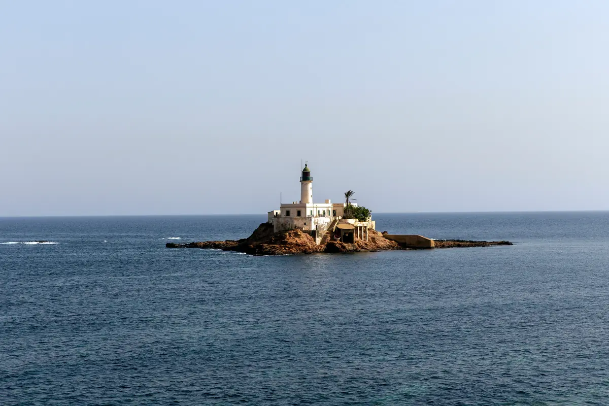
A small rock about 2.5 kilometres north-east of Arzew port carries one of the older navigation lights on the Oran coast. The 1848 lighthouse remains active, but both site and tower are closed; the appropriate encounter is usually an informed view from a safe distance.
A distinct islet in the Gulf of Arzew
Arzew Islet lies off Cap Arzew, approximately 2.5 kilometres north-east of the port according to the Lighthouse Directory. It is a compact, exposed rock whose white station and dark lantern change markedly with light, haze and sea state.
It is not part of the Habibas archipelago far to the west opposite Madagh, and it is not Île Plane, or Paloma, near Cap Falcon. All three belong to Oran’s coastal geography, but they differ in position, scale and protection or access rules.
The lighthouse built in 1848
The active light dates from 1848. Its 12-metre round white tower is built on a single-storey keeper’s house and capped by a dark-green lantern. From a focal plane of about 19 metres, it displays one red flash every five seconds.
Its published maritime identifiers are ARLHS ALG-052, Admiralty E6672 and NGA 22540. These details matter because the station is not a picturesque ruin: it is a working aid to navigation that still marks the approaches to a busy gulf.
Landing and tower access
The specialist directory describes physical access as by boat only while listing both the site and tower as closed. Boat reachability is not permission to land. Never infer access from an old photograph, social-media clip or an excursion claim that cannot provide current authorisation.
Any passage in this area calls for a lawful, properly equipped operator and same-day confirmation of local rules, wind and swell. If explicit permission is absent, remain offshore and make no attempt to step onto the islet.
How to observe and photograph it
In clear conditions, look for a lawful public space facing the cape and gulf without entering port property. Binoculars or a long lens can separate the keeper’s house, tower and lantern. Side light may reveal the rock most clearly, but a safe position and manageable wind always matter more than a particular hour.
From an authorised vessel, protect equipment from spray and let the skipper determine the distance. Never ask for a hazardous approach for the sake of a frame. The most informative picture includes the islet’s setting: cape, bay and maritime traffic explain why the light is there.
A link between two chapters of Arzew’s history
The lighthouse predates the largest industrial transformations of the modern port by many decades. It connects the nineteenth-century network of coastal lights with a gulf that later became a major Algerian energy hub.
The city guide explains that development in more detail, while the Arzew gallery places the islet in its visual context. Habibas and Île Plane reveal two other island landscapes of Oran Province, but should not be treated as alternative names for this rock.
Before approaching the shore or going to sea
- Treat the islet and tower as closed; do not land without explicit official permission.
- Check wind, swell, visibility and a safe return window on the same day.
- Use only a declared operator, a suitable boat and correctly fitted lifejackets for everyone.
- Stay outside restricted port areas and obey any photography prohibition.
- On shore, avoid wet rocks, unprotected drops and places exposed to breaking waves.