


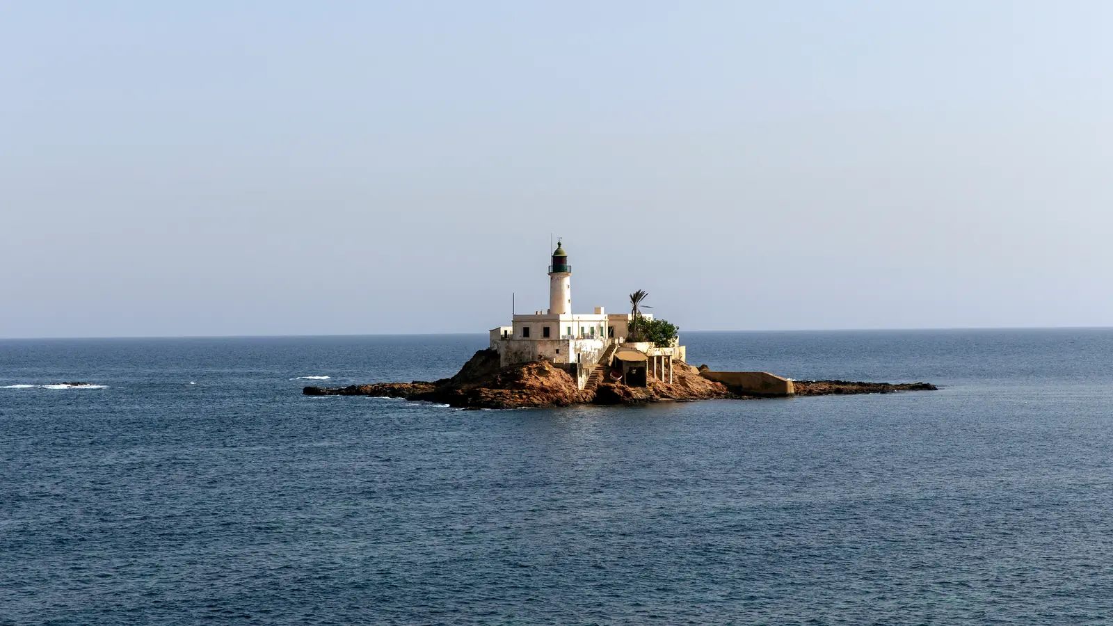
About 40 kilometres east of Oran, Arzew is a city shaped by a naturally sheltered bay, a major working port and Algeria’s modern energy economy. Its streets, harbour panorama and small lighthouse islet reward travellers who come to understand a living maritime city rather than look for a conventional resort.
Arzew in context
Arzew occupies the western shore of the broad gulf that bears its name, on the Mediterranean coast of Oran Province. Depending on the route, it is roughly 40–42 kilometres from Oran. It is neither a smaller version of the regional capital nor a purpose-built seaside resort: this is an active port town whose everyday rhythm is closely tied to shipping and industry.
The most revealing view brings several elements together—the curve of the gulf, operational port installations, urban neighbourhoods and the little islet carrying a lighthouse. Their contrast tells the story of a settlement that grew beside a natural haven before becoming a specialised energy port. Arzew is worth a stop for its geography and identity, not merely as an add-on to Oran.
How a natural harbour became an energy port
The Port of Arzew traces the modern harbour’s development to the protection offered by the bay. Its history records an early pier measuring 60 by 12 metres, built over the period from 1833 to 1870. Successive works between 1905 and 1982 transformed the scale of the facilities. The port now specialises in hydrocarbon traffic and serves the region’s petrochemical units.
Farther east in the same gulf, the Port of Bethioua was built from 1975 to 1978, with its first liquefied-natural-gas loadings in 1978. Those dates turn the panorama into more than scenery: it is a strategic part of Algeria’s economy. Operational quays and terminals remain controlled workplaces, so use only clearly public viewpoints and follow every sign.
Arzew Islet and its 1848 light
About 2.5 kilometres north-east of the port, Arzew Islet is a compact rock off the cape. Its active lighthouse was built in 1848. A 12-metre round white tower rises from a single-storey keeper’s house beneath a dark-green lantern. The light shows a red flash every five seconds from a focal plane of about 19 metres. Published identifiers are ARLHS ALG-052, Admiralty E6672 and NGA 22540.
The site and tower are listed as closed. Boat access in a technical description does not mean that landing is permitted or that tours operate. Seen from a lawful public position, or from an authorised boat keeping a safe distance, the islet gives scale to the gulf and makes a striking photograph when the white building separates clearly from the rock.
Portus Magnus is near Bethioua, not central Arzew
Arzew is often associated with the ancient name Portus Magnus, but the surviving Roman remains are in the Bethioua sector rather than in the centre of the modern city. Oran’s tourism authority presents the archaeological site, classified in 1990, as the remains of an old port town in the wider gulf. Keeping the locations distinct prevents a fruitless search for Roman ruins in present-day Arzew.
The proximity still offers a compelling regional story: the gulf provided useful anchorage in different eras, from Portus Magnus to the contemporary ports of Arzew and Bethioua. If archaeology is part of your day, confirm road and access conditions beforehand; do not assume a formal visitor centre or guaranteed opening time.
What to see and a realistic half-day
Begin with the town itself and find a clearly public place with an open view across the gulf. Identify the cape, islet and movement of vessels without crossing a barrier. A walk through streets near the waterfront, followed by coffee or a fish meal when a reliable local establishment is open, gives a truer impression of Arzew than rushing between photo pins.
The town and bay comfortably fill half a day. With a full day and current local information, continue towards Bethioua and Portus Magnus. Treat any boat outing as a separate plan requiring a declared operator, the necessary permission, full safety equipment and a suitable marine forecast. A timetable copied from an old post is not enough.
Getting there from Oran
The road journey from Oran covers roughly forty kilometres; timing depends on the starting district and traffic. A car offers flexibility. Travellers using shared or public transport should confirm both the outward option and the return locally before leaving. A mapping app can guide the road but cannot guarantee that a particular service is running.
Bring water, sun protection, comfortable town shoes and a windproof layer. Conditions beside the gulf can feel markedly cooler or rougher than those inland. Families should stay in unambiguously public places and keep children away from unprotected edges and port traffic.
Photography and respect for a working port
A medium or long lens suits Arzew: it can frame the arc of the bay, ships and the islet without approaching sensitive facilities. Obey signs immediately and avoid close photographs of checkpoints, security staff, restricted entrances or strategic equipment. If the situation is unclear, ask or put the camera away.
Do not climb onto wet or exposed rock for a slightly better angle. Wind, spray and swell can surprise even beneath a clear sky. Check the marine forecast separately from the town weather and keep the schedule flexible. A successful visit is one that understands Arzew while respecting how the city works.
Practical essentials
- Location: western shore of the Gulf of Arzew in Oran Province, about 40–42 km east of Oran.
- Character: an active energy port; signed terminals, quays and secured approaches are not visitor areas.
- Islet: active lighthouse built in 1848, roughly 2.5 km north-east of the port; site and tower closed.
- Portus Magnus: Roman remains in the Bethioua sector, separate from central Arzew.
- Time: half a day for town and bay; a full day if Bethioua is added after checking access.
- Sea: confirm permission, marine weather, equipment and operator status before any outing.